Buckeye Hills

Southwest of Buckeye, AZ on AZ-85

[image:O flag] Google Map Placemarks
[image:O flag] Safety Plan


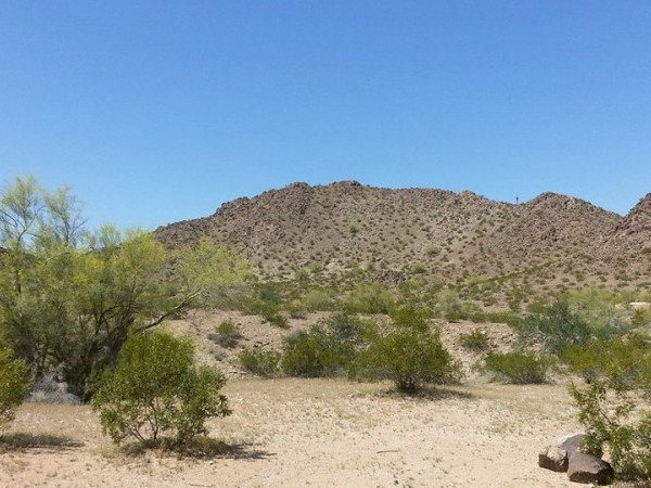
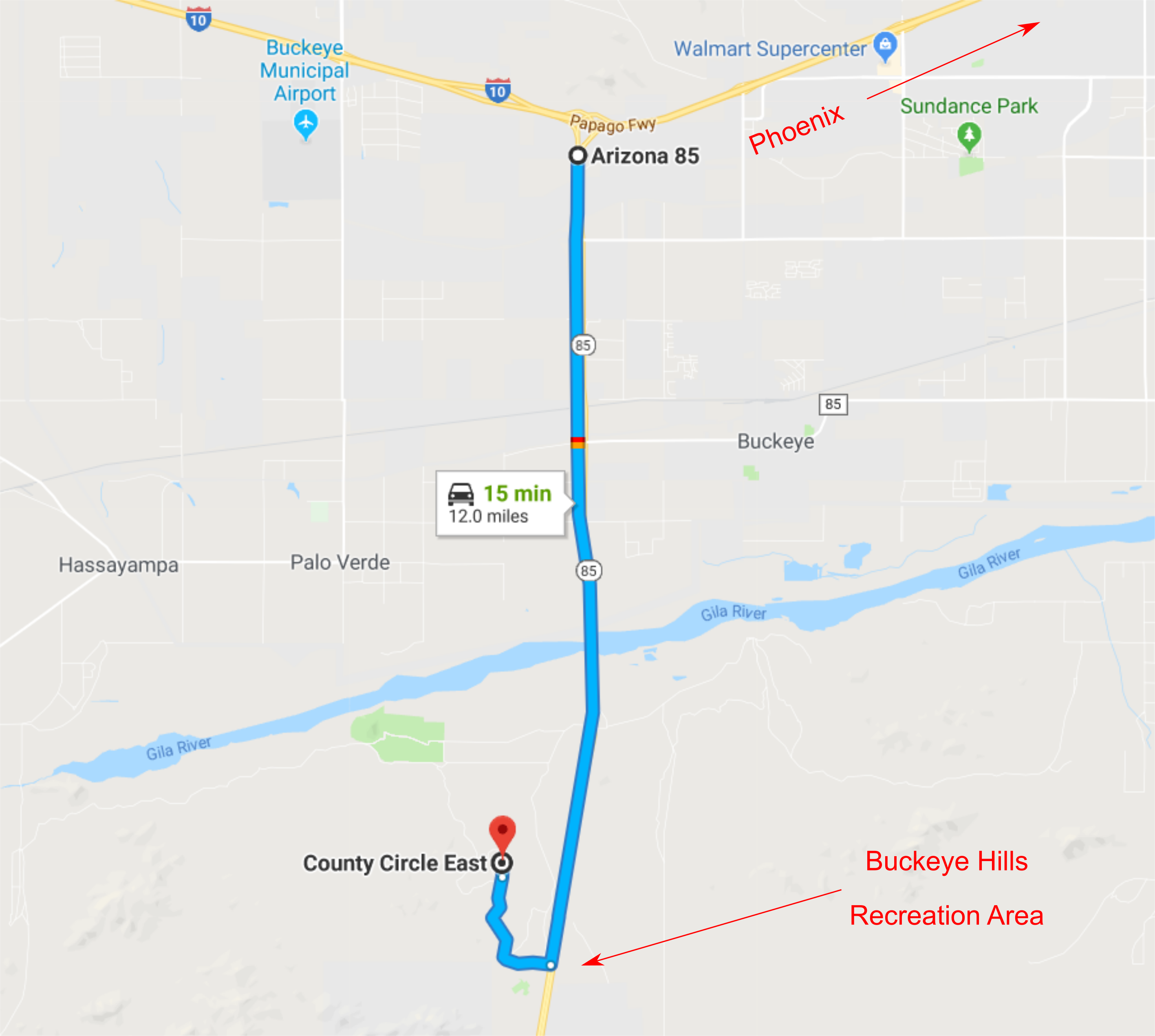
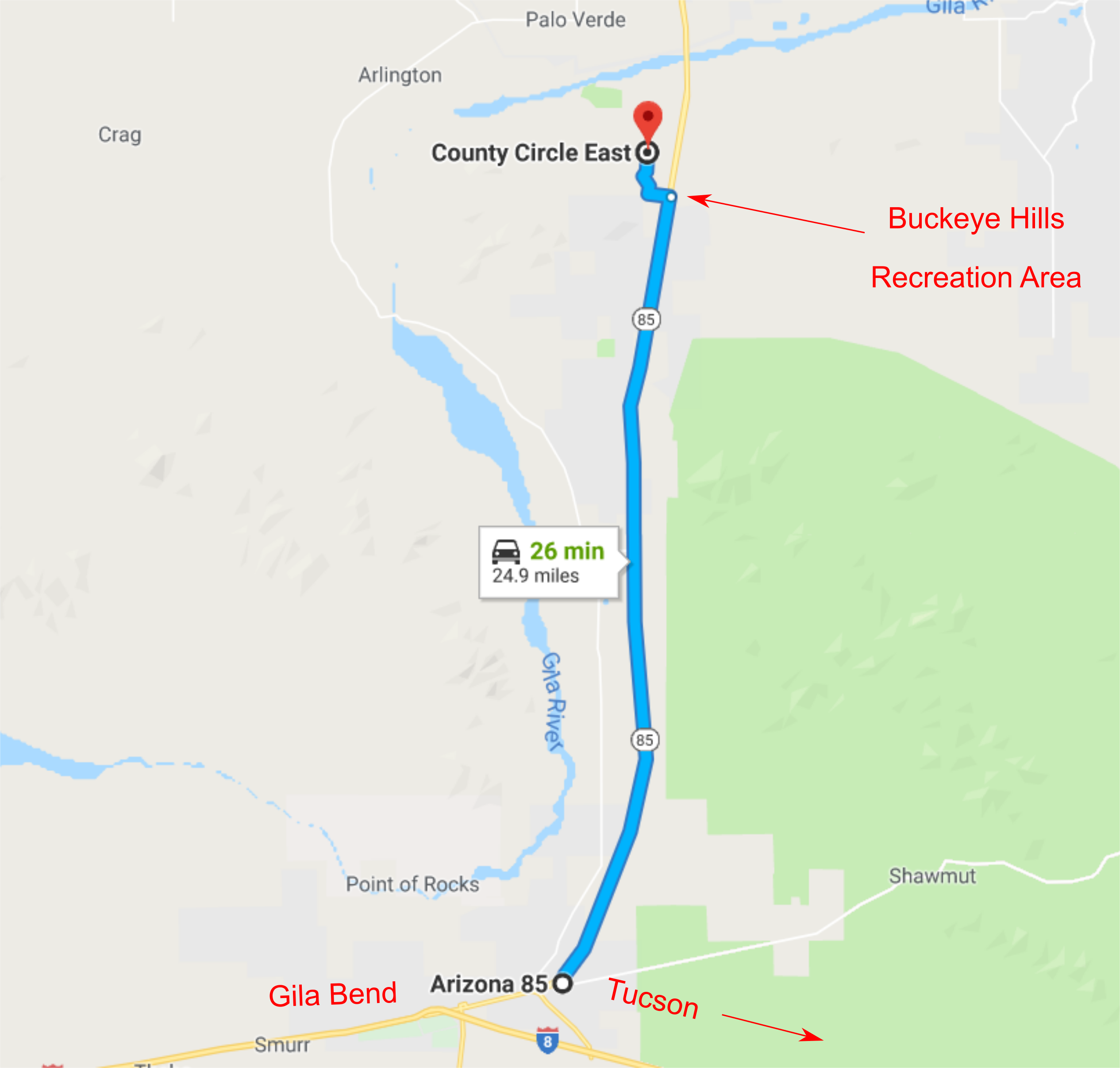
The Buckeye Hills Recreation Area is located southwest of Buckeye, AZ just west of AZ-85 at mile marker 144. The area is typical for the Lower Sonoran Desert with sparse vegetation, rocky hills and outcroppings, and complex networks of dry creeks and washes. With the absense of many of the sharp desert plants associated with other desert areas around Phoenix, the Buckeye Hills area is mostly very runnable terrain. The rocky ground around hills will somewhat slow down your progress.

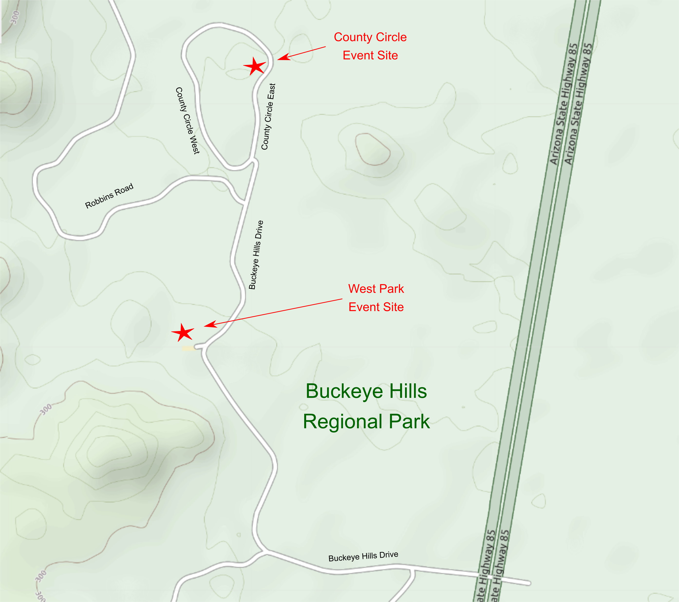
We have two event start/finish locations at the Buckeye Hills Recreation Area: County Circle and West Park (see map below).

Directions

The Buckeye Hills event sites are located south of the Gila River and just west of AZ 85.

GoogleMap Custom Directions:

  • Click here to open a browser window to a Google Maps webpage with markers at the Buckeye Hills event sites.

To get to the Buckeye Hills Event Sites from Phoenix:

  • Travel west on Interstate-10 to exit 112. The exit sign indicates "AZ85 to I-8, Yuma, San Diego".
  • Proceed south on AZ Highway 85 for about 10 miles to milepost 144 (south of the Gila River bridge). A sign indicating "Buckeye Hills Recreation Area" marks the entrance to the park. Turn right (west) onto Buckeye Hills Drive.
  • Continue approximately 1.4 miles on Buckeye Hills Drive (an all-weather dirt road accessible to all vehicles) to the West Park event site. Continue an additional 0.3 miles on Buckeye Hills Drive to the County Circle event site. Make sure to take a right at the T intersection. The start/finish is several hundred meters north of the T intersection.

To get to the Buckeye Hills Event Sites from Tucson:

  • Take Interstate-8 West from Casa Grande to Gila Bend exit 119. The exit sign indicates "To AZ85 I-10, Butterfield Trail".
  • Proceed north on AZ Highway 85 for about 24 miles to a point just before milepost 144 (before the Gila River bridge). Turn left (west) at the sign for the Buckeye Hills Recreation Area.
  • Continue approximately 1.4 miles on Buckeye Hills Drive (an all-weather dirt road accessible to all vehicles) to the West Park event site. Continue an additional 0.3 miles on Buckeye Hills Drive to the County Circle event site. Make sure to take a right at the T intersection. The start/finish is several hundred meters north of the T intersection.

Maps

Click on a map below to open an equivalent Google map in a separate window.

Directions from Phoenix
From Phoenix via I-10

Directions from Tucson
From Tucson via I-8

Map of Event Sites
From Tucson via I-8