Directions to Robbins Butte

Southwest of Buckeye, AZ

[image:O flag] Safety Plan


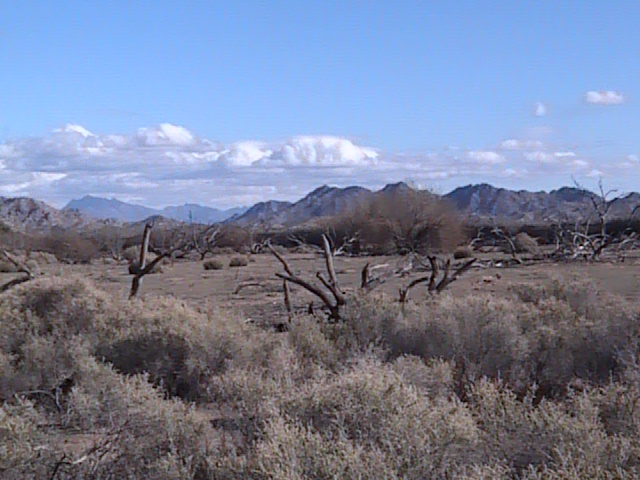
Robbins Butte is located south of the Gila River, southwest of the I-10/AZ-85 junction in Buckeye, AZ. The area contains a number of isolated ranges of hills set in the Lower Sonoran Desert. The desert vegetation here is sparse. Orienteering courses set around Robbins Butte take advantage of the very runnable terrain.

Directions

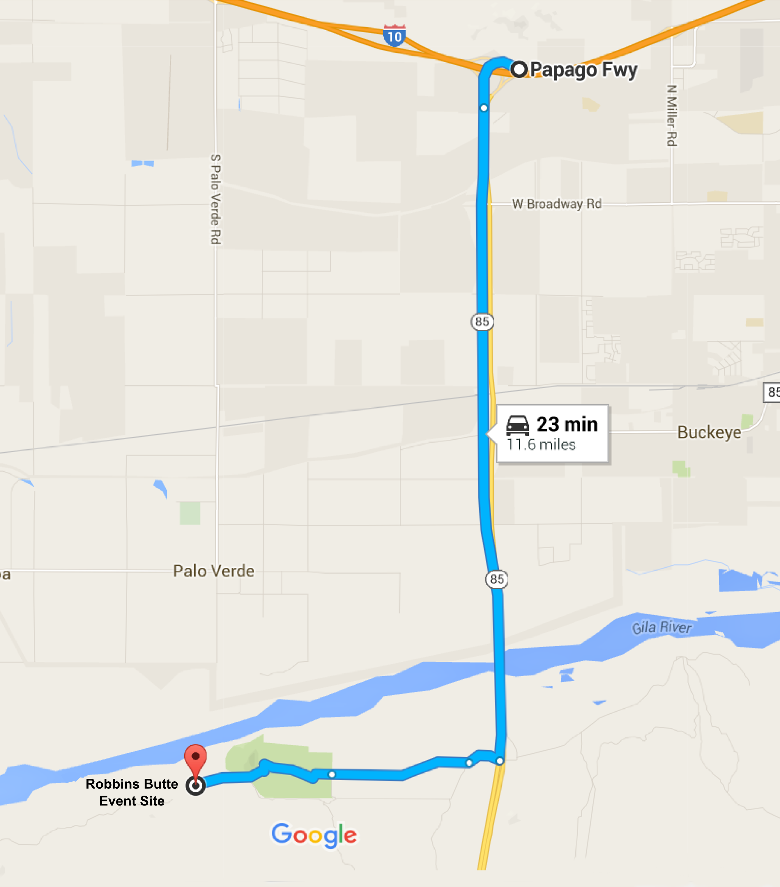
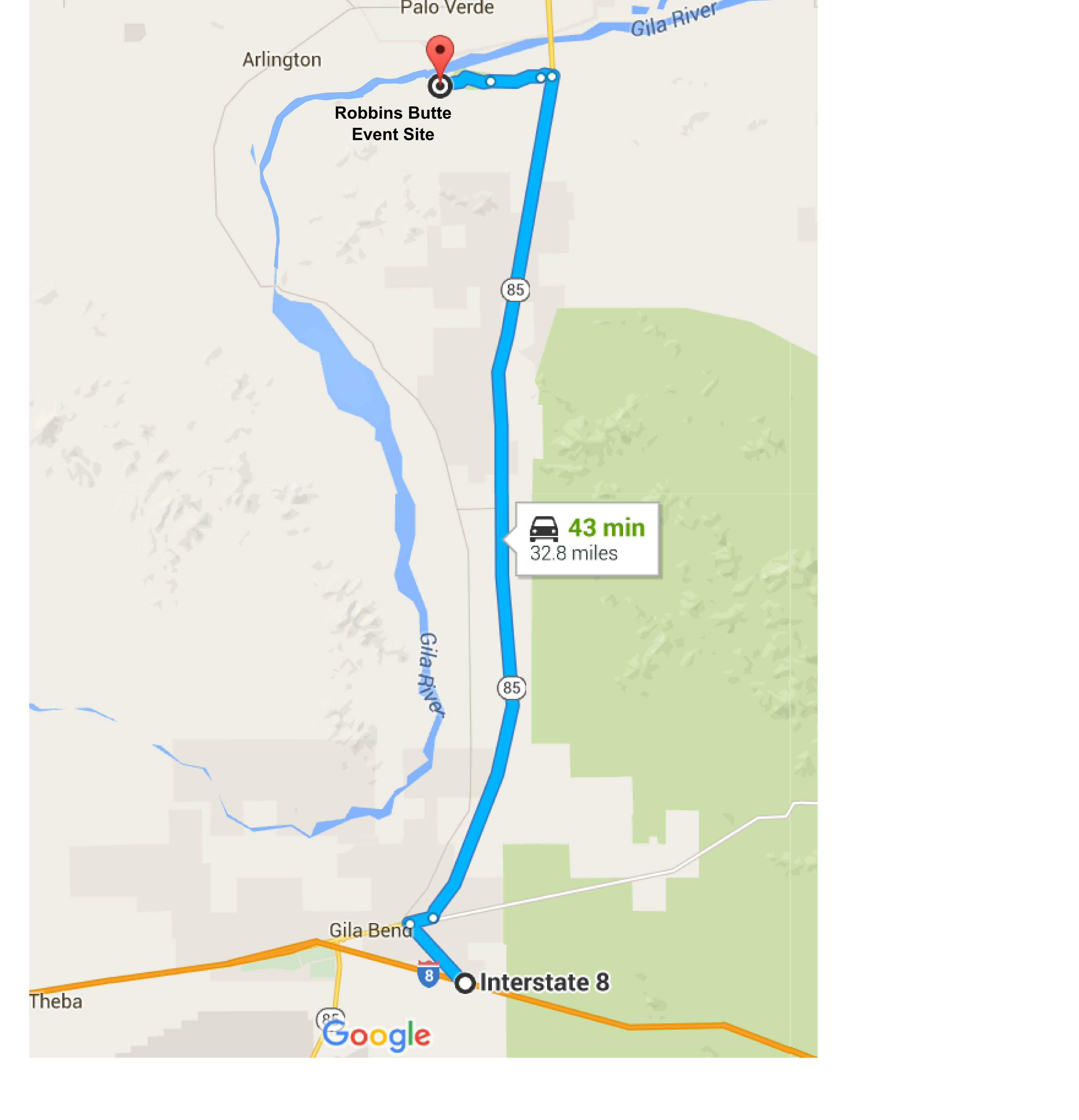
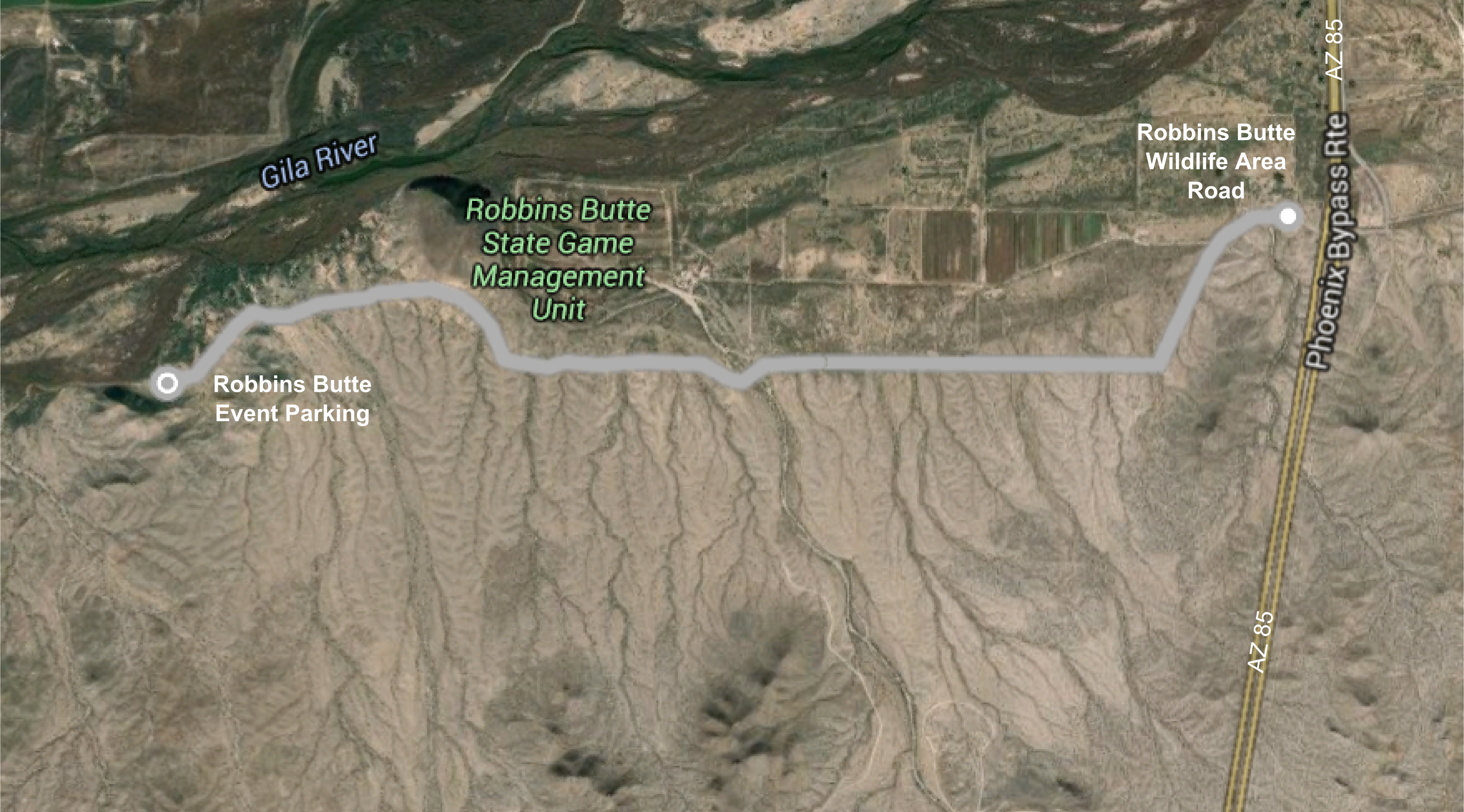
The Robbins Butte event site is located south of the Gila River about 4 miles west of AZ 85.

GoogleMap Custom Directions:

  • Click here to automatically open a browser window to a Google Maps webpage with a marker at the Robbins Butte Start area.

To get to the Robbins Butte Event Site from Phoenix:

  • Travel west on Interstate-10 to exit 112. Take exit 112. The exit sign indicates "AZ85 to I-8, Yuma, San Diego".
  • Proceed south on AZ Highway 85 for about 7 miles to milepost 147 (south of the Gila River bridge). Turn right (west) at the sign for Robbins Butte Wildlife Area.
  • Continue approximately 3.8 miles on a dirt road. Keep left when you arrive at a sign indicating "Robbins Butte Wildlife Area & access to Robbins Butte". The road is a little bumpy but passable to passenger cars.
  • Arrive at the Robbins Butte event parking and start/finish line on the south side of the road just south-east of Robbins Butte. (N33°18.8384' W112°40.8891 WGS-84).

To get to the Robbins Butte Event Site from Tucson:

  • Take Interstate-8 West from Casa Grande to Gila Bend exit 119. The exit sign indicates "To AZ85 I-10, Butterfield Trail".
  • Proceed north on AZ Highway 85 for about 27 miles to a point just before milepost 147 (before the Gila River bridge). Turn left (west) at the sign for Robbins Butte Wildlife Area.
  • Continue approximately 3.8 miles on a dirt road. Keep left when you arrive at a sign indicating "Robbins Butte Wildlife Area & access to Robbins Butte". The road is a little bumpy but passable to passenger cars.
  • Arrive at the Robbins Butte event parking and start/finish line on the south side of the road just south-east of Robbins Butte. (N33°18.8384' W112°40.8891 WGS-84).

Maps

Click on a map below to open an equivalent Google map in a separate window.

From Phoenix via I-10
Directions from Phoenix

From Tucson via I-8
Directions from Tucson

Robbins Butte Road
On the Robbins Butte Wildlife Area Road