
Thumb Butte
White Rock Event Site
Prescott, AZ
|
|
Thumb Butte is a distinct landmark located just west of downtown Prescott. The area surrounding the butte is filled with hiking and
biking trails that wind through the Prescott National Forest. The terrain is quite rugged with climbs and
descents into the area's numerous hills and drainages. The varied terrain is an excellent place to practice your
navigation skills.
|
Directions
Google Maps Custom Instructions
-
Click here to automatically open a browser window to a Google Maps webpage with a marker at the Camp Willow Springs Road event site.
(Destination Lat/Lon = 34.545929, -112.5458091)
- Enter your starting point in the starting address box.
-
The Camp Willow Springs Road event site is located in the dirt parking area at the northwest side of the
intersection. Look for orange and white orienteering signs directing you to the event site.
|
Traditional Directions
-
From Phoenix to Prescott:
-
From the I-17/Loop 101 interchange in North Phoenix, travel north on Interstate 17 approximately 47 miles to
Cordes Junction exit 262.
-
Exit I-17 at exit 262. Stay in the left lanes to merge onto AZ highway 69 towards Prescott.
-
Continue north and west on AZ 69 approximately 35 miles to downtown Prescott. Highway 69 and 89 merge
just before Prescott. Stay in the left lane as you approach the intersection with Highway 89. The
road turns into East Gurley Street and goes by Courthouse Square and Whiskey Row (mile 0).
-
From Courthouse Square to Thumb Butte Park Recreation Area:
-
From Courthouse Square, travel west on Gurley approximately 1.4 miles to where
Gurley becomes Thumb Butte Road.
-
Keep left on Thumb Butte Road and continue west for an additional 2.1 miles to the Thumb Butte Park
Recreation Area.
-
Camp Willow Springs Road Event Site:
-
After arriving at the Thumb Butte Day Use Area, continue on Thumb Butte Road for approximately
1.5 miles to the intersection with Camp Willow Springs Road.
-
The Camp Willow Springs Road event site is located in the dirt parking area at the northwest side of the
intersection. Look for orange and white orienteering signs directing you to the event site.
|
Maps
Click on a map below to open an equivalent Google map in a separate window.
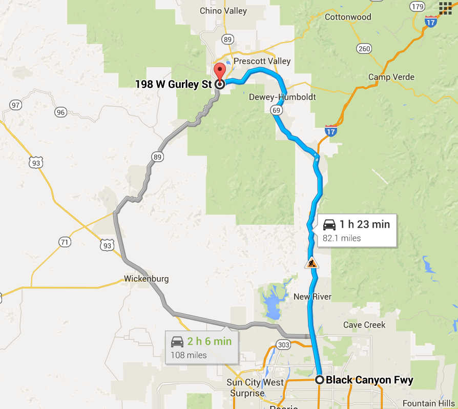
Directions from I-17 and Loop 101 in Phoenix to Courthouse Square in Prescott
|
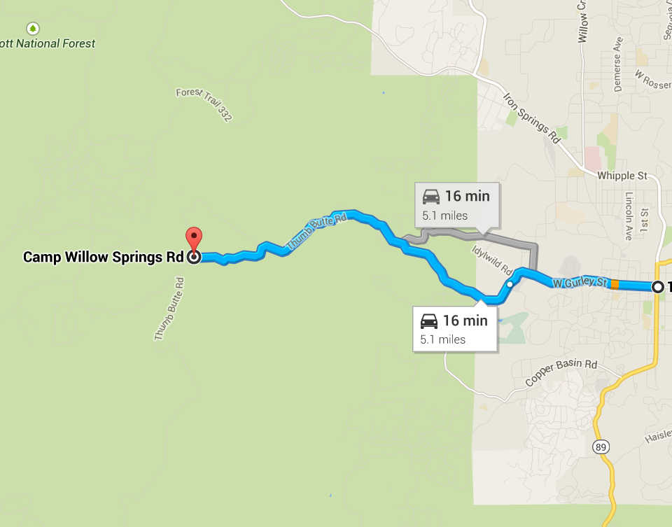
Courthouse Square in Prescott to Camp Willow Springs Road Event Site
|