
Directions to Blue Ridge Reservoir
~65 miles southeast of Flagstaff, AZ
|
|
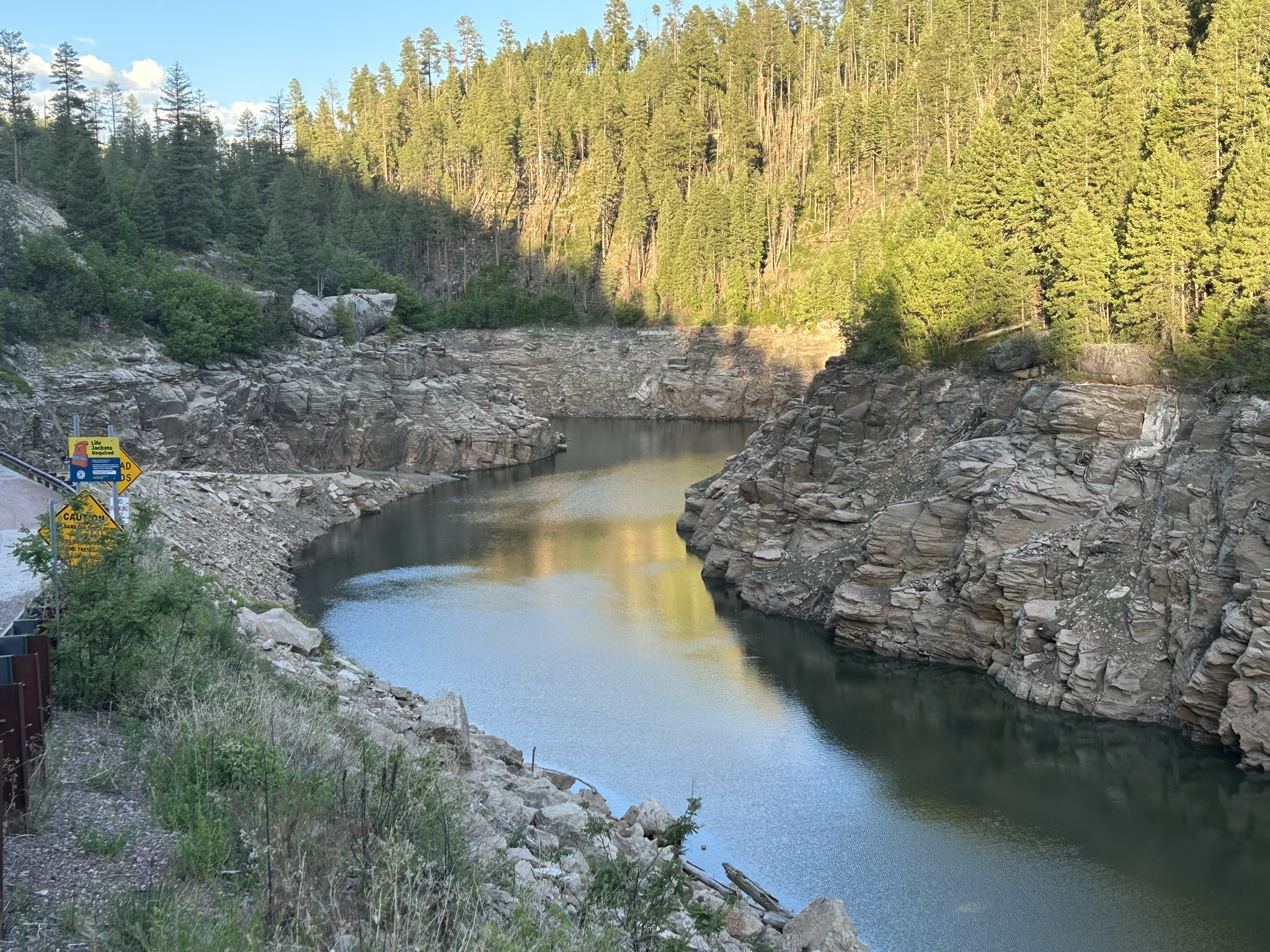
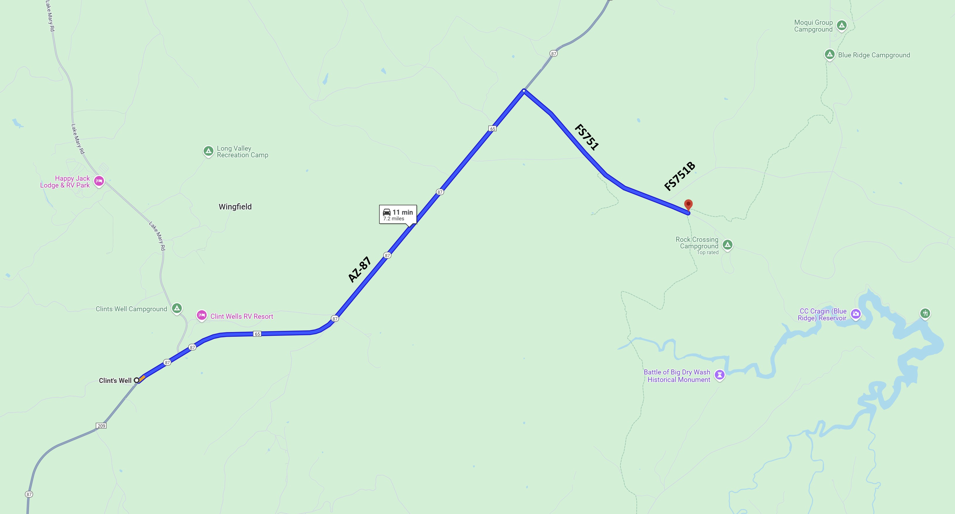
Blue Ridge Reservoir is a pretty lake located in a rugged forested area near Clint's Well, AZ. The reservoir itself is located in an area with several canyons that feed East Clear Creek. Water levels in the reservoir fluctuate considerably during the year. When the reservoir is full or nearly full, watercraft have access to spurs and re-entrants leading down to the lake. When the reservoir is low, access to the surrounding area is limited. Away from the reservoir, the area includes steep climbs up to several plateaus, then descents back down to the area surrounding the Mogollon Rim Ranger Station. The Start/Finish is not at the Blue Ridge Reservoir itself. During many times of the year, traffic in the area is quite busy, and there are few places to park at the reservoir itself. Because of this, the start/finish for events is near the junction of FS751 and FS751B. This junction is ~0.6 miles west of the Rock Crossing Campground and ~2.7 miles from the reservoir. On the day of the event, look for details provided in the event announcement. And look for orange and white orienteering signs around the forest road junction. We hope you'll join us at an event that explores this interesting Arizona area. DirectionsThere are several approaches to Blue Ridge Reservoir Start/Finish: from Flagstaff, from Camp Verde, and from Payson. The directions here assume you have reached the small service station and convenience store at Clint's Well. To get to the Start/Finish from Clint's Well:
|
Maps
Click on a map below to open an equivalent Google map in a separate window.| From Clint's Well: |
|