|
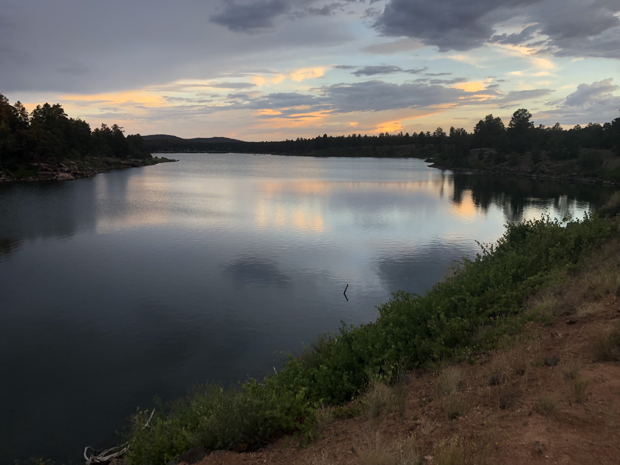
Fool Hollow Lake Recreation Area is a wonderful state park just outside the city limits of Show Low, AZ. The park has campsites, restrooms, and a beautiful lake nestled among the cliffs surrounding Show Low Creek. Unless indicated differently in the event notice, the start/finish for events is located at the Stellar Jay day-use area, just inside the park entrance.
Directions
Fool Hollow Lake Recreation Area is located along Show Low Creek near the northwest edge of Show Low, AZ. The directions here guide you to park's day-use areas.
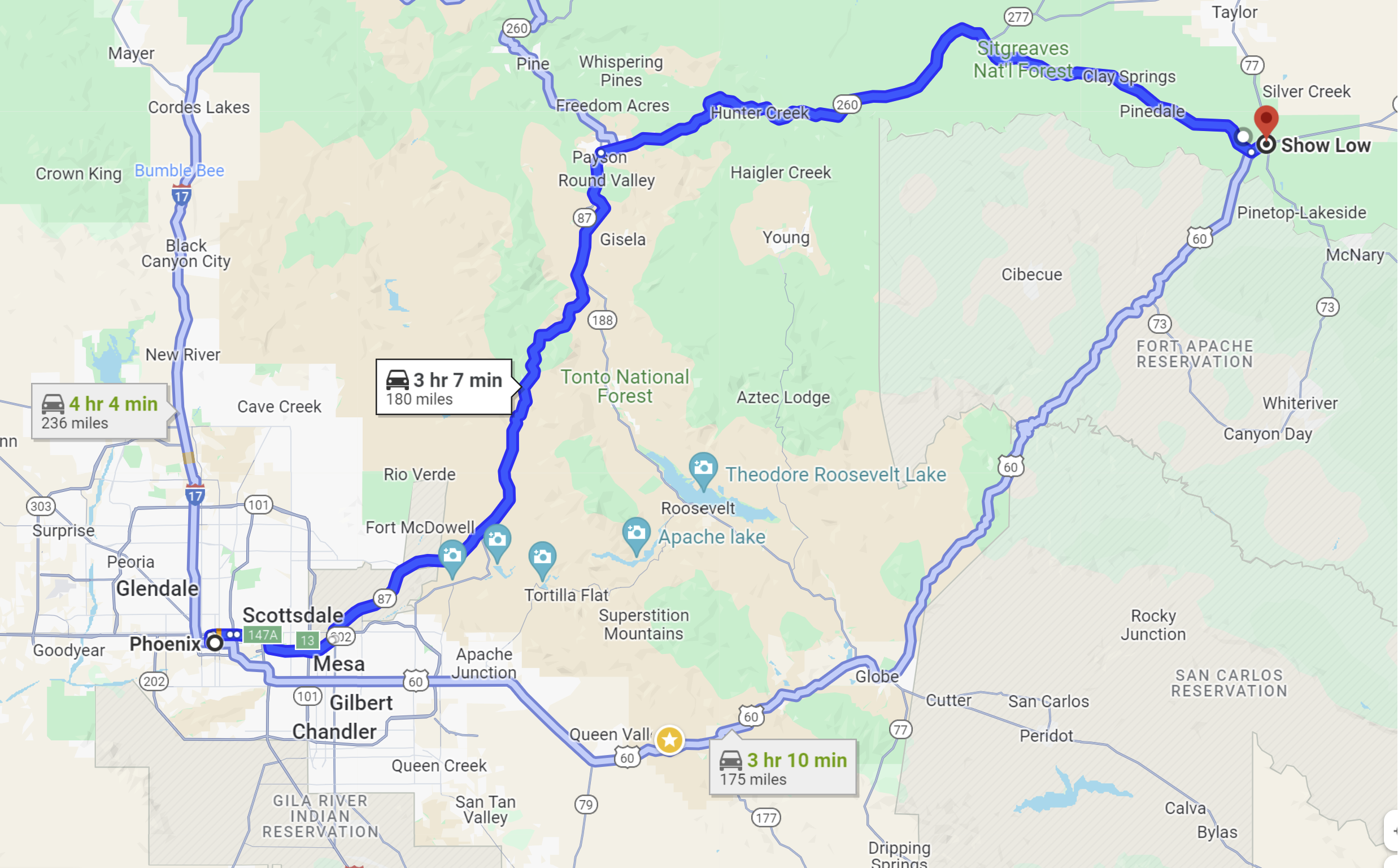
From Downtown Phoenix to Show Low, there are two main options:
-
(1) Follow AZ 87 and AZ 260 through Payson and Heber/Overgaard to Show Low (180 miles, 3:07)
-
(2) Follow US 60 through Globe to Show Low (175 miles, 3:10)
To get to the start/finish location inside Fool Hollow Lake Recreation Area:
-
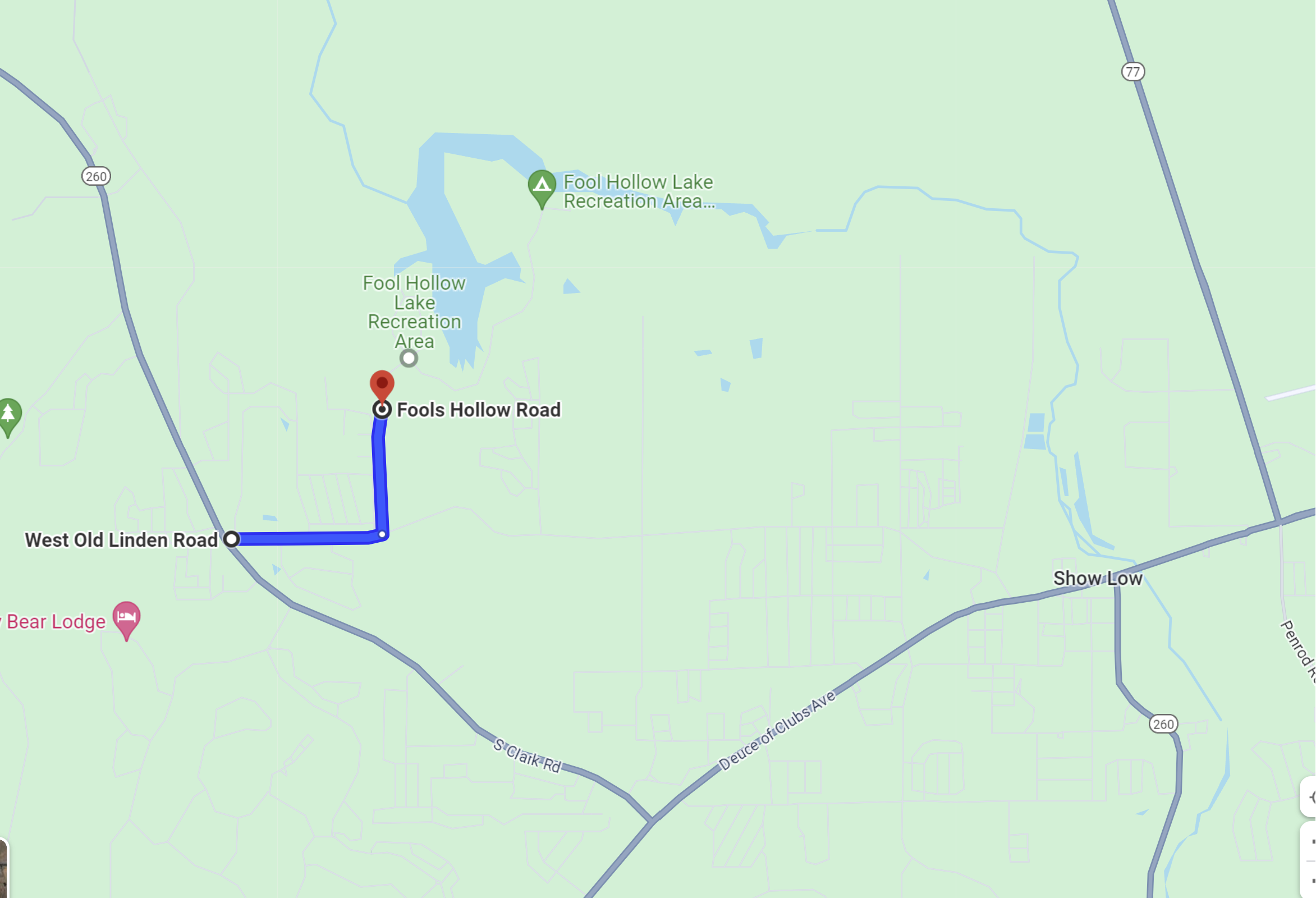
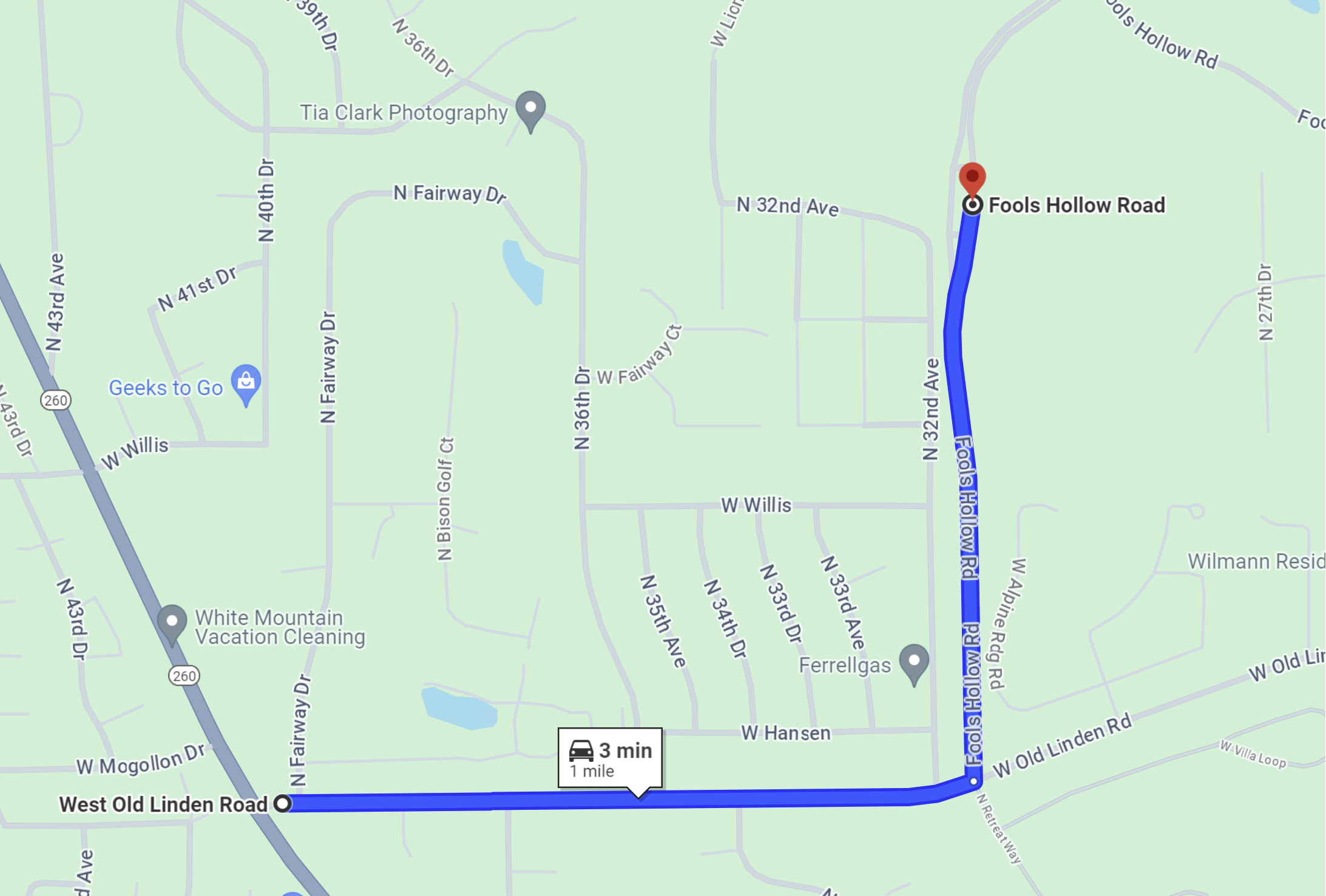
On AZ 260, on the west part of Show Low, turn east on Old Linden Road.
-
Travel 0.6 miles east on Old Linden Road to Fool Hollow Road.
-
Turn north on Fool Hollow Road and travel 0.5 miles to the park entrance station.
(Note: An entrance fee is required to enter the park.)
-
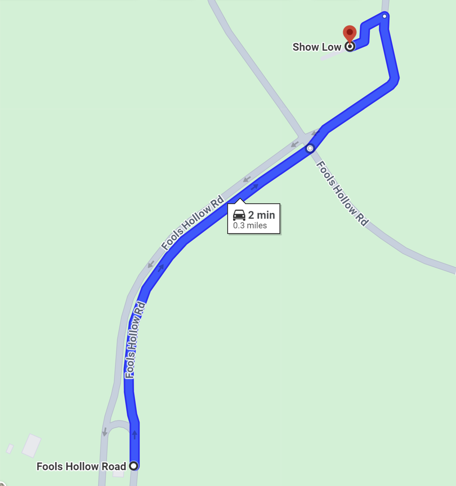
After paying the entrance fee, continue north on the park road to the first intersection. Continue straight at the intersection and drive to the first parking area on the left.
-
The start/finish is in the Stellar Jay day-use area.
|
Maps
Click on a map below to open an equivalent Google map in a separate window.
|
From Phoenix to Show Low
|
|
|
In Show Low, to Fool Hollow Lake Recreation Area
|
|
|
In Show Low, to Fool Hollow Lake Recreation Area
|
|
|
Inside Fool Hollow Lake Recreation Area, from the entrance station to the start/finish
|
|
