
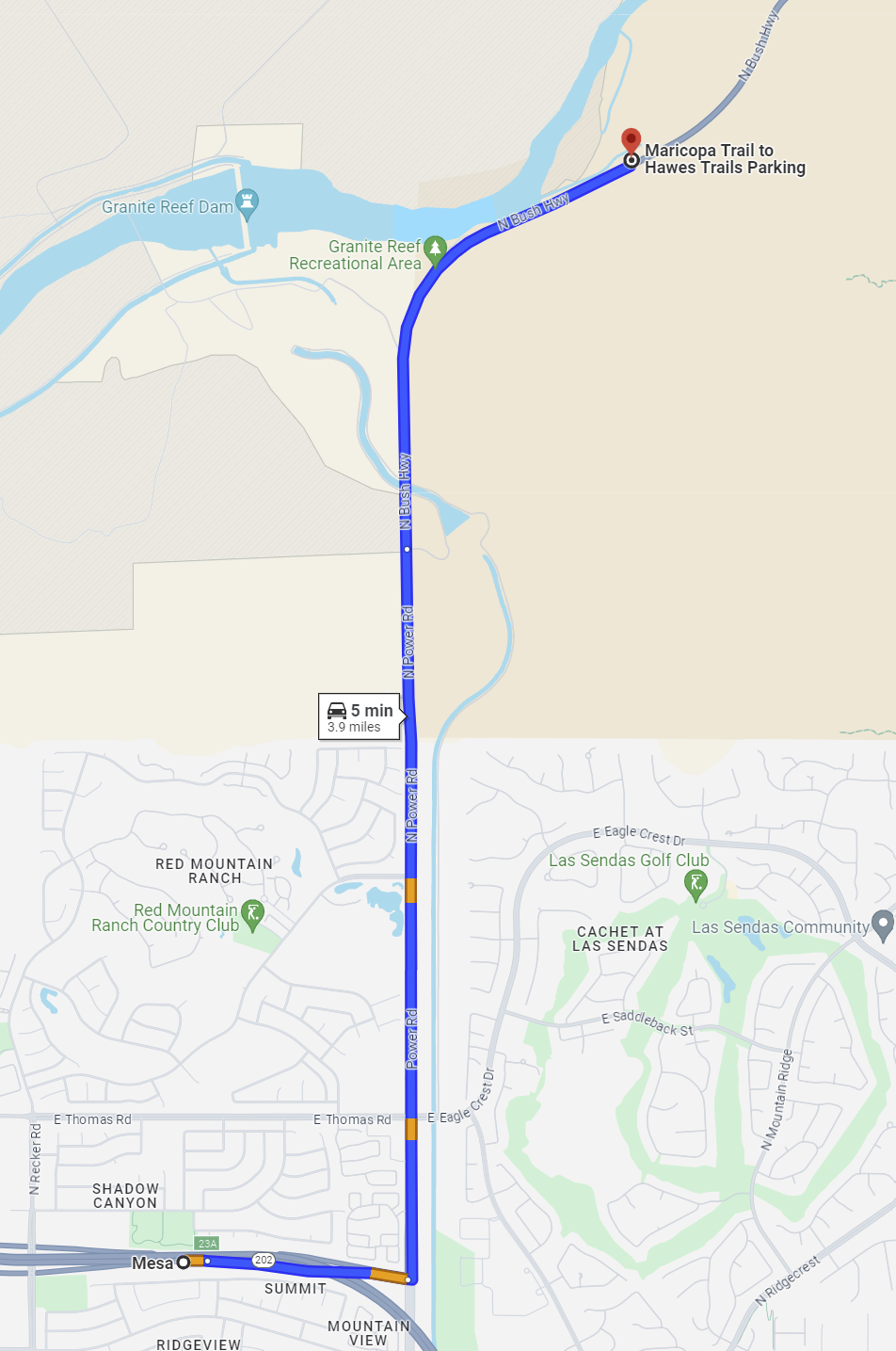
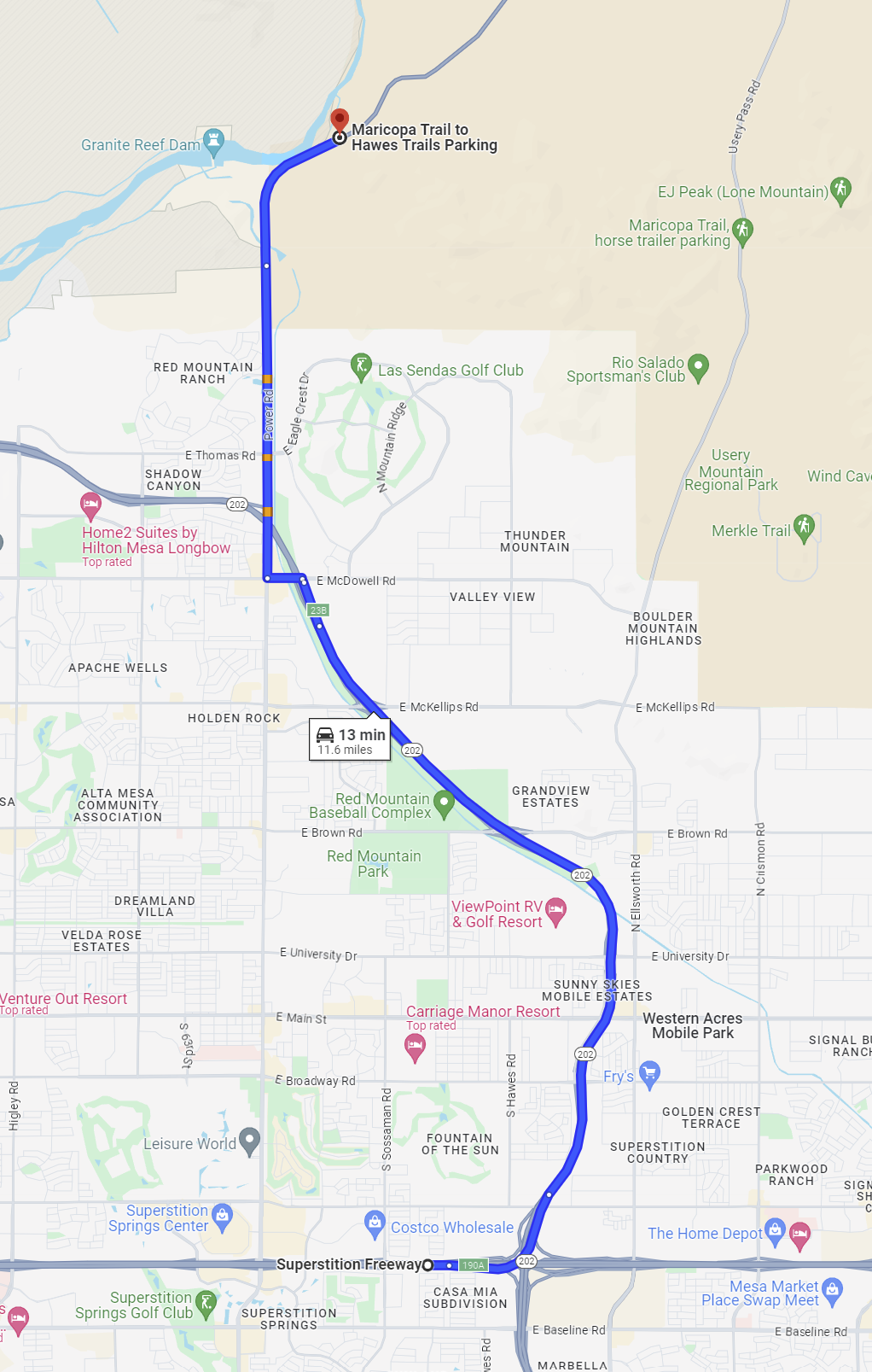
Hawes TrailheadLower Salt River, Tonto National ForestNote: A Tonto Day-Use Pass is Not Required to park at the Hawes Trailhead. DirectionsHere are recommended routes to the Hawes Traihead: AZ-202 East to Power RoadFrom Phoenix, take the 202 (Red Mountain Freeway) east to Power Road exit 23A. Turn north onto Power Road and continue approximately 4 miles to a point were the road makes a sharp bend to the east. The Granite Reef Recreation Area is located at the bend. Continue approximately 0.5 miles from Granite Reef to the Hawes Trailhead. The trailhead is on the north side of the road. Supertition Freeway East to AZ-202, North to McDowell RoadTake US 60 (the Superstition Freeway) east to the exit for AZ-202 North (exit 190). Take AZ-202 North 5.7 miles to the exit for East McDowell Road (exit 23B). Take the East McDowell Road exit then turn left onto McDowell Road. Travel west on McDowell Road for 0.3 miles to Power Road. Turn north onto Power Road and continue approximately 4 miles to a point were the road makes a sharp bend to the east. The Granite Reef Recreation Area is located at the bend. Continue approximately 0.5 miles from Granite Reef to the Hawes Trailhead. The trailhead is on the north side of the road. MapsClick on a map below to open an equivalent Google map in a separate window. |
|
|