Northern Arizona University
|
| Northern Arizona University is a Division I university located in Flagstaff, Arizona. With it's location at the base of Humphrey's Peak, NAU is the second highest Division I school in the U.S. (after the campus at the University of Wyoming). Orienteering participants coming from lower elevations will likely feel the affects of running at ~7000 feet, but they'll also benefit from the cooler temperatures and beautiful mountain vistas. We hope you'll consider joining us for some navigation fun on the NAU campus. |
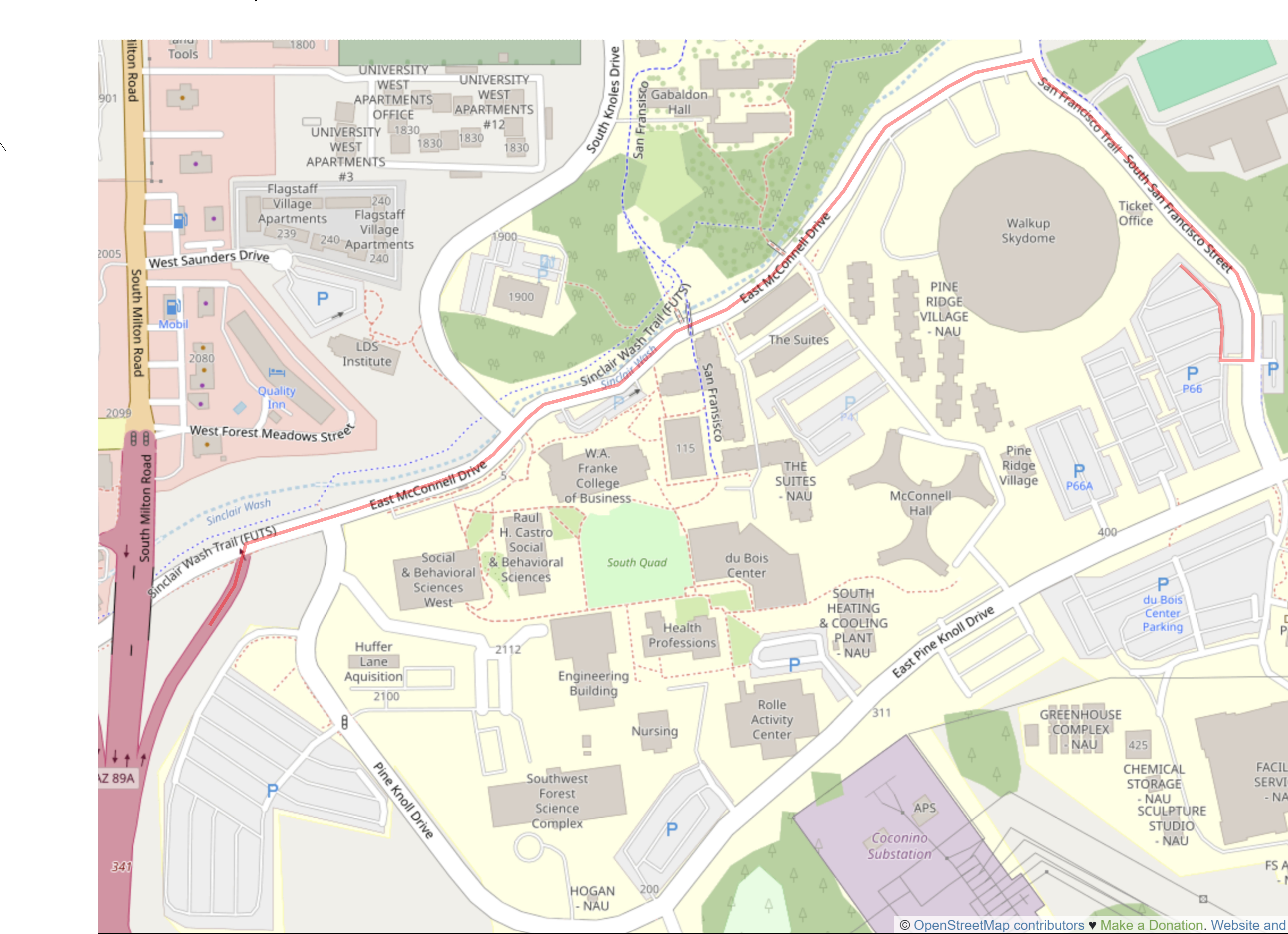
DirectionsThe NAU campus is fairly expansive. The club uses several start/finish locations for orienteering events. The details below indicate the start/finish location and additional information. ParkingPlease note that there are parking fees for most parking lots on the NAU campus. Some lots are unavailable for visitor parking. During summer months, three lots on campus are free for visitor parking, including the parking lot south of the Walkup Skydome (P66). Walkup Skydome Parking Lot (P66)The Walkup Skydome parking lot is located to the south of the Skydome. To promote visitors to the campus, parking is free in the lot from mid-June through mid-August. Google Maps Custom Instructions
|
Click on a map below to open an equivalent Google map or Open Street Map in a separate window.
