|
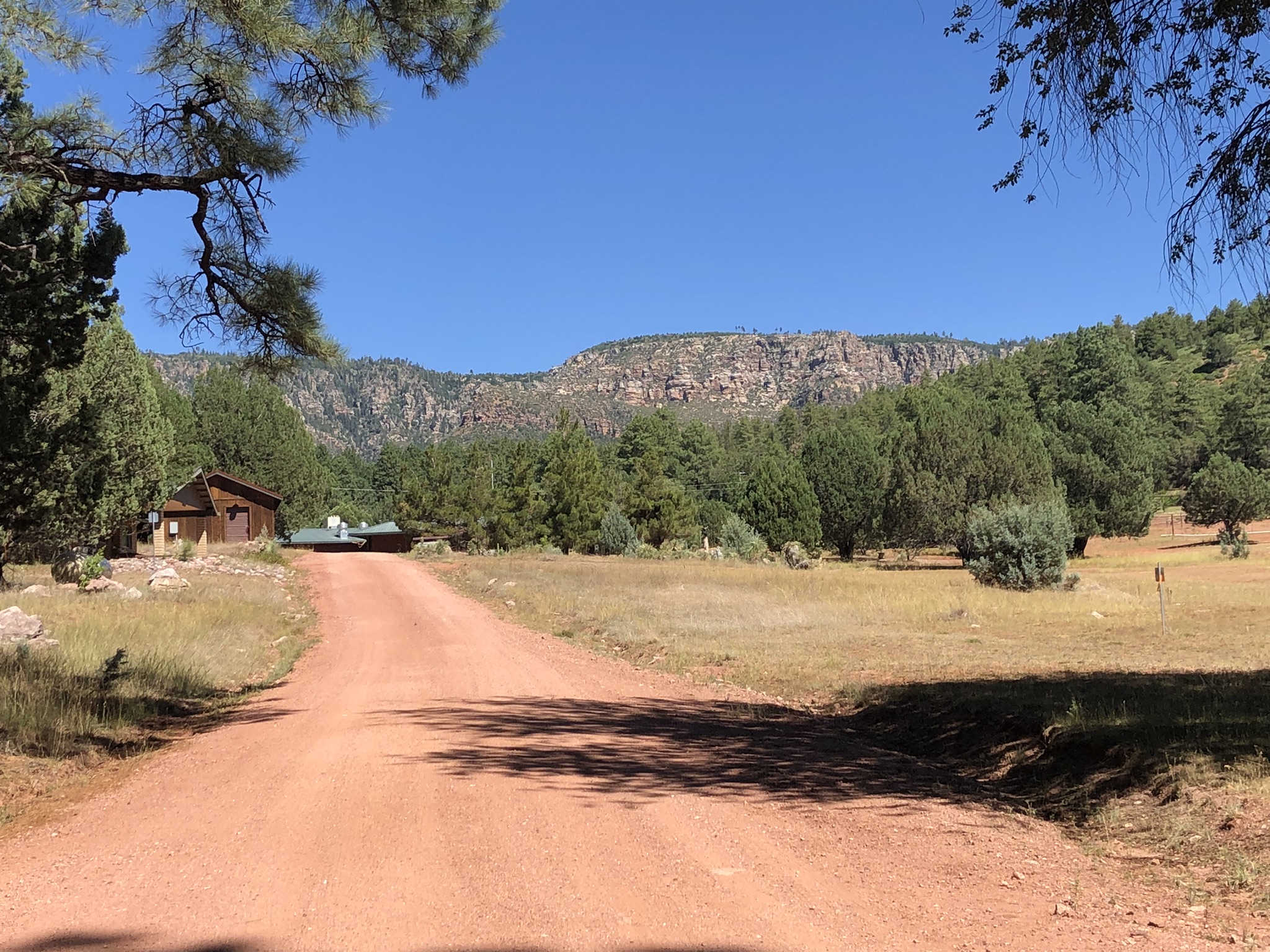
The Shadow Rim Girl Scout Camp is located ~15 miles (30 min) north of Payson, just under the Mogollon Rim. The road to the camp is mostly paved, with only the last several miles being improved gravel. The area is surrounded by a vast pine forest with views of the Mogollon Rim throughout. The Arizona Trail passes under the Rim slightly north of the camp and forms a nice boundary to the area. We hope you'll consider joining us at one of our more scenic event sites in Arizona.
|
Directions from Payson
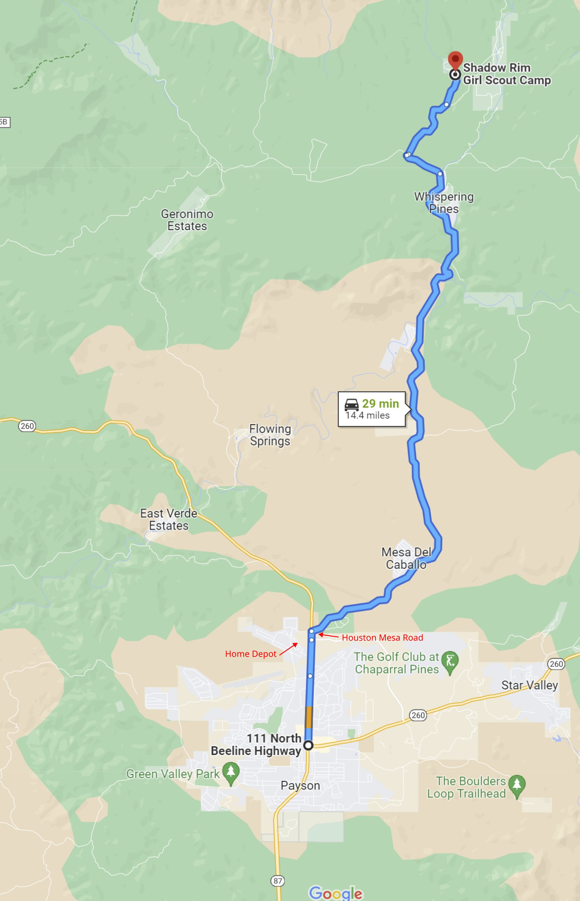
The Shadow Rim Girl Scout Camp is located ~15 miles north of Payson.
|
From from the intersection of AZ 87 and AZ 260 in the middle of Payson:
|
-
Travel north on AZ 260 approximately 1.9 miles to the Houston Mesa Road. There are two traffic circles on this route north of Payson. Continue straight (north) through each traffic circle.
-
Just past the second traffic circle, and just past Home Depot, turn right on Houston Mesa Road.
-
Follow the paved Houston Mesa Road as it winds it's way north for 10.1 miles.
-
At the stop sign, turn left and drive 0.6 miles on FS64 (Fire Control Road). The road becomes an all-weather gravel road shortly after the stop sign.
-
Turn right on FS32. A sign here indicates "Shadow Rim Ranch" is 2 miles away.
-
Continue on FS32 for ~1.2 miles to a fork in the road. Take the left branch of the road and drive 0.5 miles to the Shadow Rim Girl Scout Camp.
-
Take the left branch of the road to enter the camp. Look for orange and white orienteering signs that indicate where to park.
|
Maps
Click on a map below to open an equivalent Google map in a separate window.
|
From the intersection of AZ 87 and AZ 260 in Payson, AZ
|
|
|