Directions
Google Maps Custom Instructions
-
Click here to automatically open a browser window to a Google Maps webpage with a marker at Yavapai College.
(Destination Lat/Lon = 34.737122, -112.056153)
-
Parking is located on the south side of the campus. On weekends, there is plenty of parking to accommodate our orienteering events.
Traditional Directions
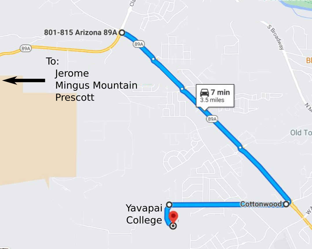
From the northwest, via US 89A (from Jerome, Prescott, Prescott Valley):
-
After traveling over Mingus Mountain on US 89A, continue to the roundabout at milepost 349.
-
Take the 1st exit (southeast) out of the roundabout to continue on US 89A.
-
Continue 2.2 miles on US 89A. For the first three roundabouts, take the second exit to continue southwest on US 89A. At the fourth roundabout, take the first exit to turn west onto West Black Hills Drive.
-
Continue on W Black Hills Drive for 1.1 miles, then turn left (south) on Gerrysue Drive. This is the entrance to Yavapai College.
-
Continue on the west side of Yavapai College until you reach the parking area on the south side of the campus. Look for the orange and white orienteering signs.
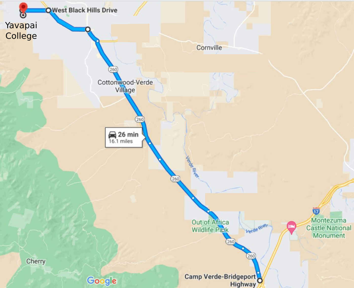
From the southeast (from I-17, Camp Verde):
-
Traveling north on I-17, take exit 287, the "Cottonwood/Payson" exit.
-
Travel west on AZ 260 for 12.9 miles to the intersection with US 89A.
-
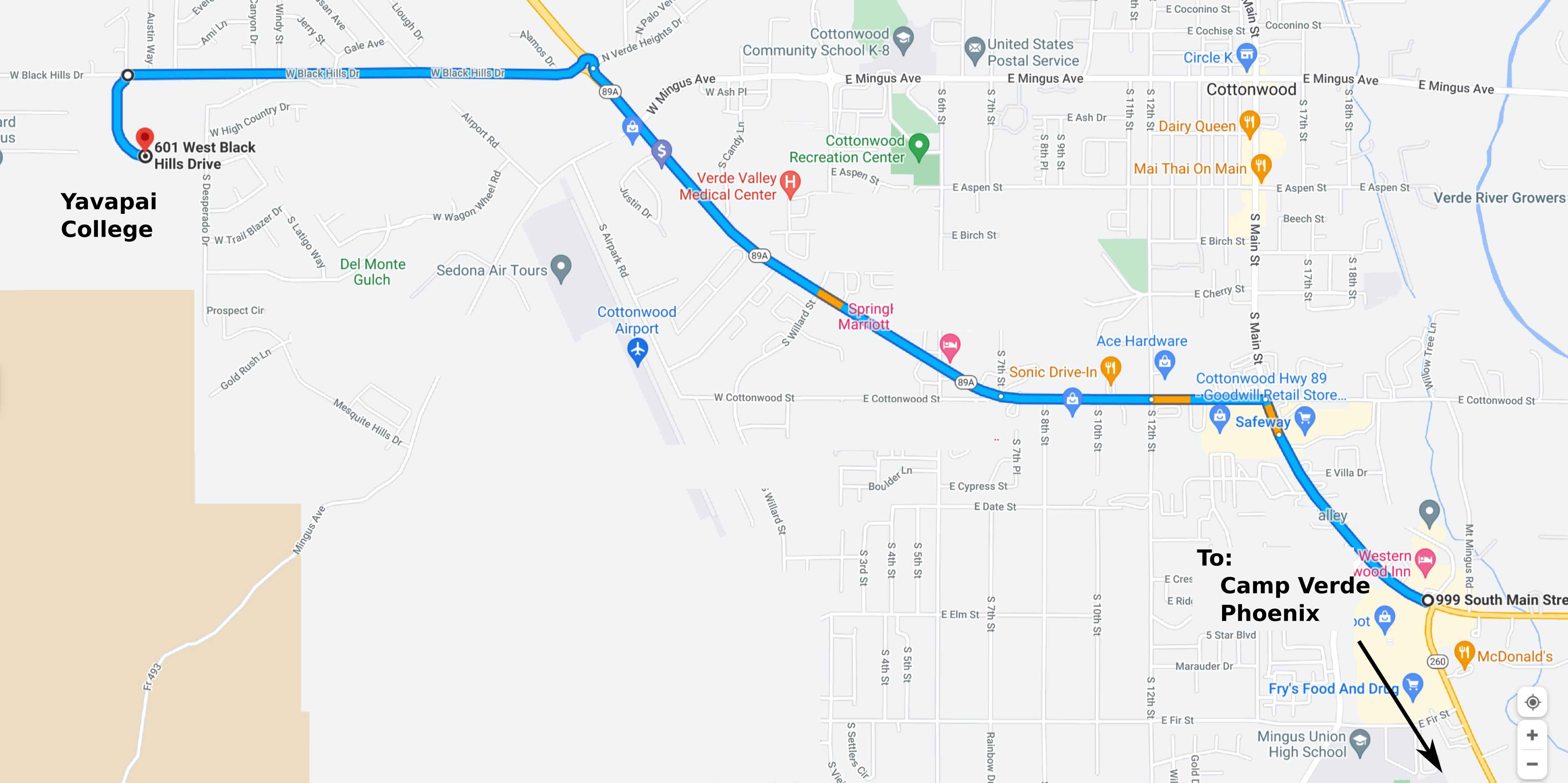
Turn left and continue west for 1.9 miles on US 89A to the roundabout at W Black Hills Drive. Take the 3rd exit to travel west on W Black Hills Drive.
-
Continue on W Black Hills Drive for 1.1 miles, then turn left (south) on Gerrysue Drive. This is the entrance to Yavapai College.
-
Continue on the west side of Yavapai College until you reach the parking area on the south side of the campus. Look for the orange and white orienteering signs.
|


